
Loading
Daniel B Stephens
  • Markets & Services
    • Laboratory Services
      • Instrumentation/Automation
      • Research/Development
      • Sensor Calibration
      • Soil Properties Testing
    • Environmental Data
      Management
      • Custom Web Applications
      • Data Management
      • GIS/Mapping
      • GLA-Data
      • Site Visualization/Analysis
    • Oil/Gas/Energy
      • Carbon Management
      • Natural Resources
      • Permitting/Compliance
      • Water Supply/Development
    • Engineering
      • Mining
      • Remediation
      • Stormwater
      • Solid Waste
      • Water/Wastewater/Reuse Systems
      • Funding Assistance
    • Natural Resources
      • Biological Services
      • Clean Water Act Compliance
      • Cultural Resources Services
      • Environmental Impact Studies
      • Watershed Management
    • Contaminated Sites
      • Indoor Air Vapor Intrusion and Risk Assessment
      • Operation/Maintenance/Monitoring
      • Petroleum Storage Tank Sites
      • PFAS Investigations
      • Remediation
      • Superfund Sites
      • Site Investigation/Characterization
      • Vadose Zone Hydrology
    • Water Planning/Development
      • Brackish Water/Salinity
      • Engineering
      • Geochemistry
      • Modeling
      • Public Involvement
      • Recharge/Reuse/Recycling
      • Stormwater
      • Sustainable Groundwater Management
      • Vadose Zone Hydrology
      • Watershed Management
      • Water Planning
      • Water Quality
      • Water Rights
      • Water Workshops and Training
      • Wells/Wellfields
      • Funding Assistance
    • Litigation/
      Expert Services
      • Experts
      • Contaminated Sites
      • Indoor Air Vapor Intrusion/Risk Assessment
      • Mining
      • PFAS Investigations
      • Vadose Zone Hydrology
      • Water Rights/Disputes
    • Mining
      • Closure/Reclamation
      • Engineering
      • Environmental Site Characterization/Remediation
      • Hydrogeology/Geochemistry
      • Permitting/Regulatory Compliance
      • Soils/Geotechnical Laboratory Analysis
      • Water Management/Supply
      • Enhanced Metal Recovery
    • Solid Waste
      • Compliance Monitoring
      • Construction Quality Assurance
      • Interim and Final Closure
      • Laboratory Services
      • Modeling
      • Permitting and Design
      • Stormwater Management
  • About
    • Principal Professionals
    • Representative Projects
    • Publications and Water Plans
    • Awards & Rankings
    • Community
  • News
  • Careers
  • Contact
  • Click to open the search input field Click to open the search input field Search
  • Menu Menu
You are here: Home1 / News2 / Events3 / Numerical Modeling to Estimate Groundwater PFAS Migration

Numerical Modeling to Estimate Groundwater PFAS Migration
Events, Projects


Numerical Modeling to Estimate Groundwater PFAS Migration Downgradient of Air Force Base AFFF Source Area

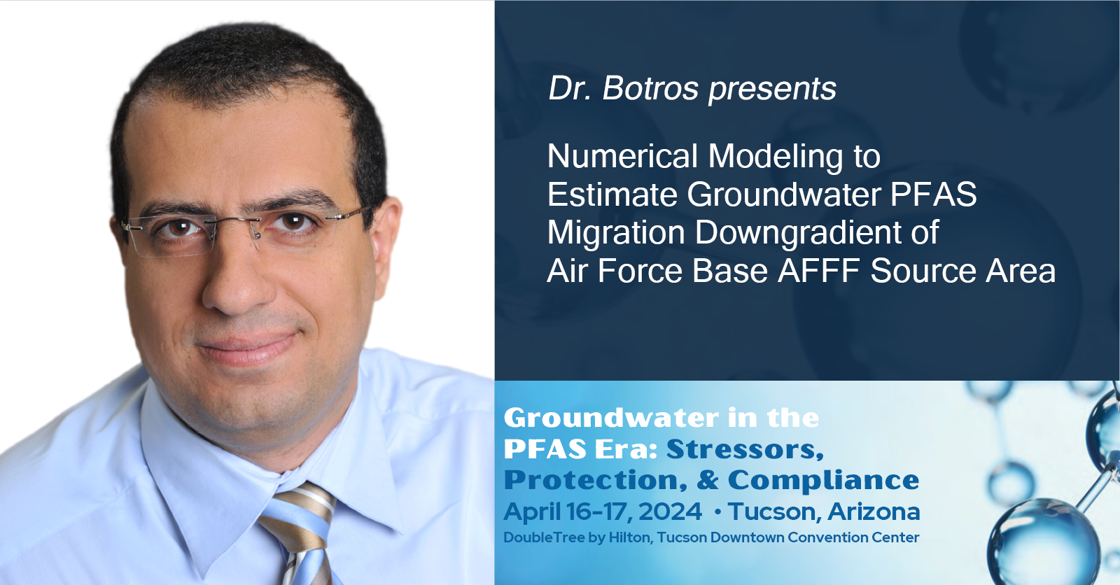
Dr. Farag Botros, PE, will be presenting “Numerical Modeling to Estimate Groundwater Per- and Polyfluoroalkyl Substances (PFAS) Migration Downgradient of Air Force Base Aqueous Film-Forming Foam (AFFF) Source Area” at the National Ground Water Association (NGWA) Groundwater in the PFAS Era: Stressors, Protection, and Compliance event taking place on April 16 to 17, 2024, in Tucson, Arizona. Learn more about DBS&A’s PFAS Investigation expertise. Read more about PFAS regulations on the U.S. Environmental Protection Agency website.

Conference overview

The chemistry and environmental behavior of PFAS, combined with recent and proposed regulatory actions and toxicological uncertainties, create significant challenges for groundwater management and protection. This NGWA conference provides a forum to share best science and state-of-the-practice approaches to address PFAS contamination while maintaining groundwater’s essential roles for drinking water, agriculture, environmental, and other purposes. The conference provides an opportunity to share lessons learned in addressing this high-profile and rapidly evolving issue.

Presentation

Numerical Modeling to Estimate Groundwater PFAS Migration Downgradient of Air Force Base AFFF Source Area

Co-authors:

Farag Botros, PhD, PE, Gregory Schnaar, PhD, PG, Neil Blandford, PG (Daniel B. Stephens & Associates Inc.) and Amy Ewing, PG (Hazen and Sawyer)

Abstract Text:

Numerical groundwater modeling was conducted to assess potential PFAS migration from Cannon Air Force Base (AFB) in Curry County, New Mexico. Wells that have had PFAS detections or are at potential risk of future PFAS contamination were first identified and sampled, including one newly installed monitoring well downgradient of the AFB. Site hydrogeology was investigated, and potential migration pathways were determined to be coincident with paleochannels identified in the High Plains (i.e. Ogallala) aquifer.

Work began using an existing regional groundwater flow MODFLOW model that covers a large area in Texas and New Mexico, including Cannon AFB and downgradient. The results of the regional model were used to obtain the hydraulic head values at the boundaries of a smaller, local-scale groundwater model that was developed in the vicinity of the AFB using MODFLOW-NWT code. Aquifer hydraulic properties for the local model were initially taken from the existing regional model. These values were later modified during model calibration. Calibration was conducted using an automated parameter estimation program (PEST) that required more than 1,000 local model simulations to obtain optimum hydraulic conductivity values that focused on minimizing the difference between measured and simulated groundwater elevations. Automated hydraulic conductivity parameter estimation was constrained by local geologic maps including the presence and orientation of paleochannels.

The local MODFLOW-NWT model was used to simulate PFOS and PFOA fate and transport downgradient of Cannon AFB using MT3D-USGS. PFAS source location and concentrations were based on available AFB groundwater monitoring data and partition coefficients were obtained from the ITRC literature database. PFAS plumes were predicted to extend more than 1 mile from the AFB boundary to a concentration in the nanogram per liter range. Modeling results may be used to site additional monitoring wells for plume delineation and understanding the extent of potential downgradient PFAS impacts.

Read more about the project here. 

April 15, 2024
Share this entry
  • Share on Facebook
  • Share on WhatsApp
  • Share on LinkedIn
  • Share by Mail
https://www.dbstephens.com/wp-content/uploads/2022/10/DBSA-website-color-logo-300x65.png 0 0 db_stephens_admin https://www.dbstephens.com/wp-content/uploads/2022/10/DBSA-website-color-logo-300x65.png db_stephens_admin2024-04-15 08:01:002024-04-15 08:02:54Numerical Modeling to Estimate Groundwater PFAS Migration
Search Search

Recent Posts

  • 2026 Land and Water Summit
  • DBS&A Supports NMED Emerging Contaminants Program
  • Carbon Capture, Utilization, and Storage 2026

Daniel B. Stephens & Associates, Inc.


6501 Americas Parkway NE, Suite 200
Albuquerque, NM 87110

Phone  505-822-9400
Fax  505-822-8877

Locations

  • California

  • Colorado

  • New Mexico

  • Texas

  • Washington, DC

Information

  • Services
  • News
  • Community
  • Contact

Work With Us

DBS&A Careers
© 2026 Daniel B. Stephens & Associates, Inc. | Phoenix Web Design by Kinetik IT
  • Link to LinkedIn
  • Link to Youtube
  • Link to Facebook
  • Employee Intranet
  • Legal notice
Link to: 2024 New Mexico Water Workshop Link to: 2024 New Mexico Water Workshop 2024 New Mexico Water WorkshopLink to: ENR Top Design Firm Link to: ENR Top Design Firm ENR Top Design Firm
Scroll to top Scroll to top Scroll to top