
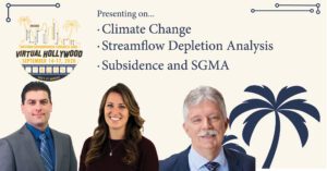
 DBS&A Hydrogeologists, Tony Morgan, PG, CHG, Douglas Tolley, PhD, and Kaelyn Schwartz, GIT, will be presenting virtually to geologists, engineers and other groundwater scientists at the Groundwater Resources Association of California (GRAC) Western Groundwater Congress on September 14 through September 17, 2020. Sessions will focus on water resources, the Sustainable Groundwater Management Act (SGMA), contaminants and more. Learn more about DBS&A’s water resources capabilities. Learn more about the event.
About the presentations:
Tony Morgan, PG, CHG, Vice President and Principal Hydrogeologist, will present “So the Climate is Changing… Now What?” We are reminded on a daily basis by a variety of scientists, entertainers, politicians, activists, television pundits, and engaged stakeholders that the climate is changing. We hear generalized conclusions such as “…dry areas will get drier, and wet areas will get wetter…” or “…precipitation will occur more frequently as rain rather than snow…” that are, in many instances, derived from global-scale climate models.
Despite advances in global climate models and the recent popularity of global-scale groundwater models, management of groundwater in California is practiced and regulated at the basin and sub-basin scale. The newly formed Groundwater Sustainability Agencies (GSAs) across the state have responsibilities for their specific basin. As a consequence, the GSA perspective is more basin-scale focused rather than global.
The County of Ventura has been an active participant in the Integrated Regional Water Management (IRWM) planning process for many years. The IRWM process requires planning efforts to consider the how water resources might be impacted by climate change. Stakeholders in the County engaged the Desert Research Institute (DRI) to review output from 32 Global Climate Models and downscale the results so they could be applied at the county-scale.
DRI developed projected changes to temperature, precipitation, and evapotranspiration by comparing the 1950-2005 baseline to the 2021-2040 period. Average temperature increases were 2-3oF at the coast and 3-5oF for inland areas. Evapotranspiration predictions showed the greatest change from baseline conditions, with increases of 5-10%, in the upper Santa Clara River watershed. Although change in average annual precipitation volume was less definitive as model results showed both increases and decreases, there was agreement that precipitation intensity would increase (fewer days of precipitation).
The anticipated climate changes for Ventura County are not expected to be “apocalyptic”, but do warrant special planning to adapt and take maximum advantage of the changing hydrologic conditions. Ephemeral streams dominate the natural surface water conveyance features and their inherently flashy responses are motivating creative responses. Local water agencies are developing plans, for example, to upgrade their infrastructure to capture the higher intensity surface water events and deliver that water to spreading basins for aquifer recharge or to irrigators in lieu of groundwater pumping. Off-river flooding of suitable lands (floodMAR) has been proposed to augment formal spreading basins. These and other projects that help capture some of these high-intensity storm events will mitigate the predicted impacts of climate change and help Venture County groundwater basins achieve their sustainability goals. For a sneak peek of Tony’s presentation, click here.
Gus Tolley, PhD, DBS&A Hydrogeologist, will present “Streamflow Depletion Analysis for an Intermittent Stream, Scott Valley, CA” prepared in conjunction with Laura Foglia of Larry Walker Associates and Thomas Harter of UC Davis.
Quantification of streamflow depletion due to groundwater pumping using field measurements is notoriously difficult as it requires controlling for many variables that are not under human control. Estimation of streamflow depletion has thus fallen back on mathematical methods based on physical principles. All analytical depletion models and some numerical depletion models lack the ability to represent dry stream sections. This poses a problem since the very reason streamflow depletion is a concern is because surface-water resources are finite at certain times of the year. We use the Scott Valley Integrated Hydrologic Model to perform a spatially distributed streamflow depletion analysis in the basin. Model results show that dry stream sections can significantly change streamflow depletion behavior from that predicted by the current conceptual model. Temporary streamflow depletion rates of up to an order of magnitude greater than the pumping rate were observed. Furthermore, the water year type (e.g., wet, average, dry) has a significant influence on the spatial and temporal distribution of streamflow depletion rates. We propose modifications to the current conceptual model of streamflow depletion, as it does not accurately predict depletion results when stream sections are allowed to go dry. For a sneak peek of Gus’ presentation, click here.
Kaelyn Schwartz, GIT, Staff Hydrogeologist, will present “Subsidence and SGMA – Characterizing the Ups and Downs Outside of the Central Valley” (prepared in conjunction with Douglas Tolley, PhD, and Tony Morgan, PG, CHG.
The Central Valley of California is recognized as a focal point for induced subsidence due to a combination of geologic factors and heavy reliance on groundwater extraction in dry years. The California Department of Water Resources and the U.S. Geological Survey have committed extensive resources to identify the areal extent of and quantify the change in land surface elevation in this region. Many Groundwater Sustainability Agencies outside of the Central Valley are wrestling with subsidence as an element within their Groundwater Sustainability Plan and find that the resources for characterizing subsidence are more limited.
An assessment of subsidence is often complicated by multiple processes that can result in changing ground surface elevation. The extraction of petroleum or gas resources or tectonic activity can interfere with the interpretation of the causal factors for land surface movements. Multiple data sets, if available, can help narrow the list of potential causal factors and aid in determining if the land surface elevation changes are the result of groundwater extractions or other activities or processes.
Evaluation of the subsidence Sustainable Management Criteria in the Fillmore and Piru groundwater basins in Ventura County, CA involved the use of qualitative data sets (e.g., locations of hydrocarbon extraction activities, general geologic setting, lithology of hydrostratigraphic units, inferred subsidence from groundwater models), as well as more quantitative (e.g., geodetic surveys, local and regional benchmarks, InSAR) data. These qualitative and quantitative data sets were largely used to characterize the presence/absence of historical subsidence events and to assess the relative magnitude of the land surface movement. A spreadsheet screening tool that incorporates the geomechanical properties of the hydrostratigraphic units and future groundwater levels, as determined by climate change or groundwater management actions, was used to develop future subsidence risk assessments for each basin management area.
Land subsidence can interfere with infrastructure (e.g., buildings, roads, canals, pipelines) and land use (e.g., drainage, flood risk) which can come with significant costs. Establishing risk assessments for land subsidence allows GSAs to more appropriately allocate resources to investigation, monitoring, or remedial actions. For a sneak peek of Kaelyn’s presentation, click here.